Introduction to geographic information system (GIS) data (data type and structure or vector vs. raster data):
Definition of GIS: A system of hardware, software, and procedures designed to support the capture, management manipulation, analysis, modelling, and display of spatially referenced data for solving complex planning and management problems” (Rhind,1989)
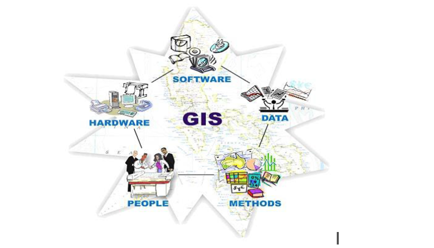
GIS components: it is an integration of five components
- Hardware
- Software
- People
- Data
- Analysis
All the components should be in balance, if the system is to function satisfactorily.

Data Model concept: Data represent a simplified view of the real world, physical entities or phenomena are approximated by data in GIS (Spatial location, extent of the physical entities, non-spatial properties). Objects or features are abstractions in a spatial database.
Spatial objects are the objects in a spatial database representing real-world entities with associated attributes
In a GIS system, Coordinates are used to define the spatial location and extent of geographic objects and Attribute/non-spatial data are linked with coordinate data to define each spatial object in the spatial database.
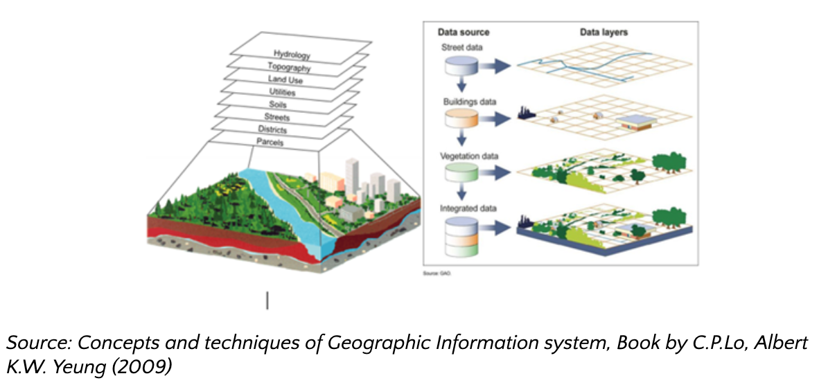
Most conceptualizations or models view the world as set of layers and each layer organizes the spatial and attribute data for a given set of cartographic/spatial objects (e.g., Lake, river, road, etc.)

Definition: Attribute data
Attribute data are the information linked to the geographic features (spatial data) that describe features. That is, attribute data are the “non- graphic information associated with a point, line, or area elements in a GIS.” Labels affixed to data points, lines, or polygons.
Attribute data are categorized as nominal, ordinal, or interval/ratio:
- Nominal attributes: variables that provide descriptive information about an object e.g., colour, vegetation type, city name, owner of parcel, soil type etc.
- Ordinal attributes: variables that imply rank order or scale by their values
- Ordinal attribute may also be descriptive (e.g., small, medium, large, low, moderate, high, ranging from 1 to 5 (soil erosion level), etc.
- Interval/ratio attributes are used for numeric items where both order and absolute difference in magnitudes are reflected in the number
- Real number on a linear scale, e.g., area, length, weight, height, depth, value, etc. are represented by interval/ration variables
“GIS” is an acronym for Geographic Information Systems, this is the system that creates, manages, analyses, and maps all types of data. On the contrary to the name itself it does not only include geographic type of problems and data but is applicable to different areas of work. For a better understanding of the principles of GIS you can watch the video below:
