Spatial Analysis concept
Spatial analysis is the process by which we turn raw data into useful information. Spatial analysis is the crux of GIS because it includes all of the transformations, manipulations, and methods that can be applied to geographic data to add value to them, to support decisions, and to reveal patterns and anomalies that are not immediately obvious. In a narrow sense, spatial analysis has been described as a method for analysing spatial data, while in a broad sense it includes revealing and clarifying processes, structures, etc., of spatial phenomena that occur on the Earth’s surface.
GIS Analysis Functions
Once the data input process is complete and GIS layers are pre-processed, someone can begin the analysis stage. GIS analysis functions use the spatial and non-spatial attribute data to answer questions about real-world. Analysing geographic data requires critical thinking and reasoning. When use GIS to address real-world problems, you will come up against the question that which analysis function you want to use and to solve the problems.
GIS analysis functions help look for patterns, associations, connections, interactions, and evidence of change through time and over space.
Functionally, GIS provides a sophisticated tool for reporting the results of a database. These reports may be for an entire dataset (or table) or for a portion of the dataset (e.g., based on the results of a query or data summary).
Geospatial data is any type of data that contains a geographic component (it contains a location in any coordinate system). Geospatial data can be a simple point or a more complex shape with lines and boundaries (lines, polygons). Data usually contains not only location but also elevation and other informative attributes, e.g., area, shape, poverty rates, population density, information on traffic, different pixel values (in raster), …
These properties of data allow us to perform certain functions on them. We can divide these functions by their spatial attributes, spatial relationship and creating new geometries.
Spatial attributes:
Area – are attribute tells us about the surface of the spatial data (polygon), measured in different units (e.g., m2, km2, ha, …)

Source: GeoCodis
Perimeter - continuous line forming the boundary of a closed geometrical figure.

Source: GeoCodis
Length - gives us the information about longitude of a specific spatial data (line, polyline)
Min, Max - we can measure, calculate, determine, evaluate or add different minimums or maximum of spatial data. (e.g., lowest or highest elevation)
Spatial relationship:
Intersect - function intersect extracts the portions of features from the input layer that overlap features in the overlay layer. Attributes are assigned to the intersection layer.

Source: GeoCodis
Contains - a geospatial polygon can contain other geospatial data or different attributes.
Distance - the length of the space between two points. This also includes distance between point and polygon or between two polygons since geometric centroid is always included in the measuring and not the whole surface.

Source: GeoCodis
Equals - meaning something is the same as another or has the same status or quality.
Creating new geometries:
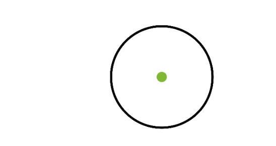
Centroid - centroid is a centre point of the object (polygon). It is the point where all three medians of the triangle intersect

Source: GeoCodis
Buffer - is an area within the specified distance of a point, line or a polygon

Source: GeoCodis
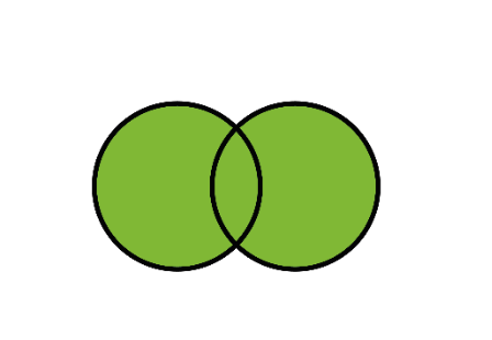
Union - is a function that combines different geospatial data into a single composite layer, preserving the attributes and boundaries of both (all)

Source: GeoCodis
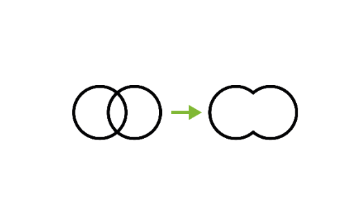
Dissolve - is a function that unifies different geospatial data, while unifying their boundaries. Dissolve is based on the common attribute values and will only be performed when this condition is satisfied

Source: GeoCodis
Analysis FUNCTIONS of GIS Includes:
- Measurements
- Query
- Extraction (clip, select, split etc...)
- Proximity
- Classification
- Overlay analysis
- Topology
- Network analysis …
Tools that are openly available to you:
- QGIS: Welcome to the QGIS project!
- https://docs.qgis.org/3.22/en/docs/gentle_gis_introduction/index.html
- ArcGIS About ArcGIS | Mapping & Analytics Software and Services (esri.com)
- PostGIS About PostGIS | PostGIS
- PostgreSQL PostgreSQL: The world's most advanced open source database
